Timber Harvesting in the Uinta National Forest GIS Analysis
Project Description
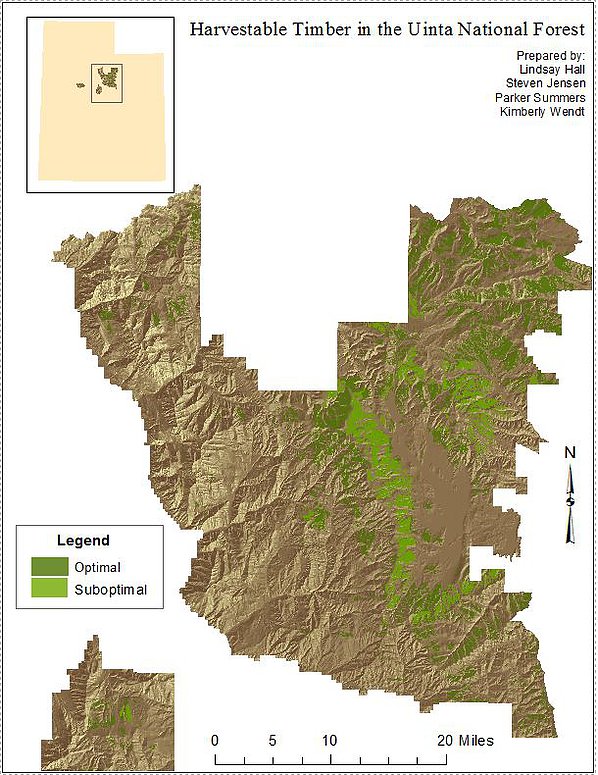
The goal of this project was to determine suitable areas for timber harvesting in the Uinta National Forest, located in the Wasatch Mountains. Certain criteria has to be met before an area can be harvested. This project combined all of the criteria together using GIS analysis to locate the optimal sites for timber harvesting.
Skills Used
- Spatial Analysis
- Model Builder
Steps Taken to Complete Project
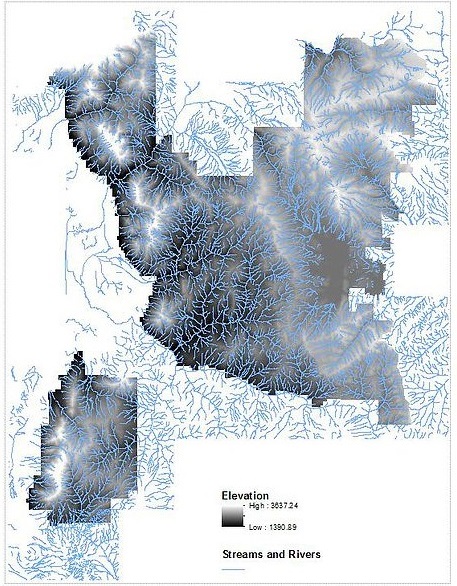
Elevation data was collected for this area because the slope of the land must be less than 21.8 degrees to be suitable for harvesting. Harvesting is also not allowed within a certain distance of rivers and streams. This distance is calculated based on the size of the stream.
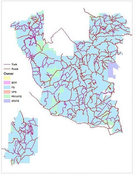
Harvesting is also not allowed with 400 meters from maintained trails. Trees cannot be harvested within 100 meters from roads, but they must be harvested within 500 meters from roads for access purposes. The land must also be owned by the Forest Service.
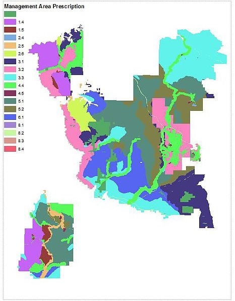
The Management Area Prescription must be appropriate for timber harvest. Areas that are off limits include: wilderness and recommended wilderness areas, research natural areas, undeveloped areas, developed recreation, mineral development, utility corridor / communication sites, administrative sites, and recreation residences.
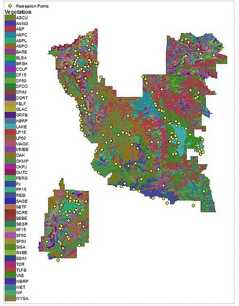
Timber harvesting is not allowed within 500 meters of a recreation or campsite. Only certain types of forest communities are suitable for harvesting. These include: all areas classified as conifers (Lodge Pole Pines, Spruce Fir, Douglas Fir) with greater than 60% crown density, all types of Aspen and Aspen/conifer mixed forest except Aspen/Oak mixtures.
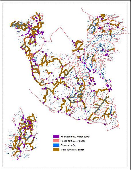
I created buffers of different sizes (according to the set criteria) around the recreation points, roads, streams, and trails layers. These buffer areas are not suitable for timber harvesting.
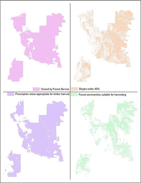
These four maps show the areas suitable for timber harvesting: land owned by the Forest Service, areas with slopes under 40%, prescription management areas appropriate for harvesting, and suitable forest communities.
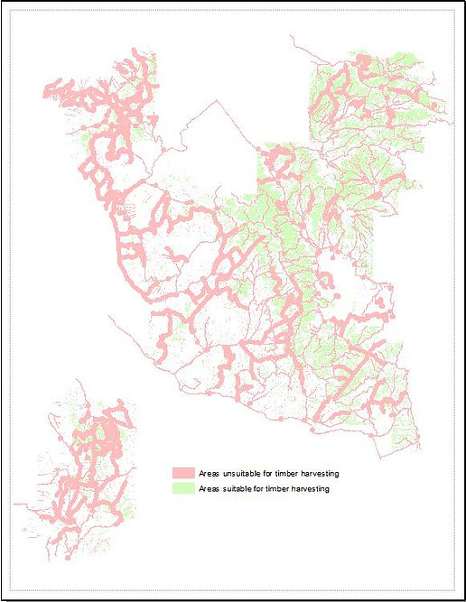
All of the unsuitable areas from the top left map were added together (a union) to create one layer. All of the suitable areas from the top right map were overlayed and areas that were common to all four inset maps were put together (an intersection) to create a second layer.
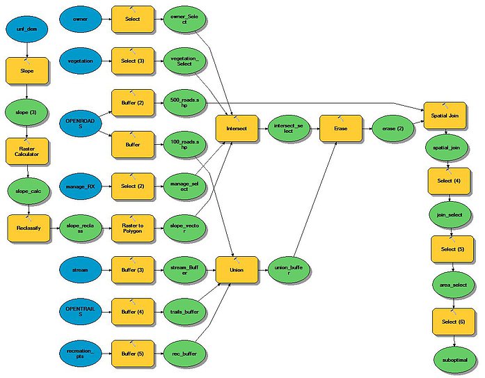
This is the model I used to analyze the different data layers to determine the optimal and suboptimal locations for timber harvesting. After the analysis shown in the previous maps, I erased the unsuitable locations from the suitable locations. Then I performed a spatial join to combine the 500 meter road buffer with the current suitable locations. I selected areas that were larger than 10 hectares, since one of the criteria for timber harvesting is that the site cannot be smaller than 10 hectares. Finally, I selected areas that had a Prescription Management Area of forested ecosystems - vegetation management, since those areas are suboptimal compared to other Prescription Management Areas.
Back to Projects