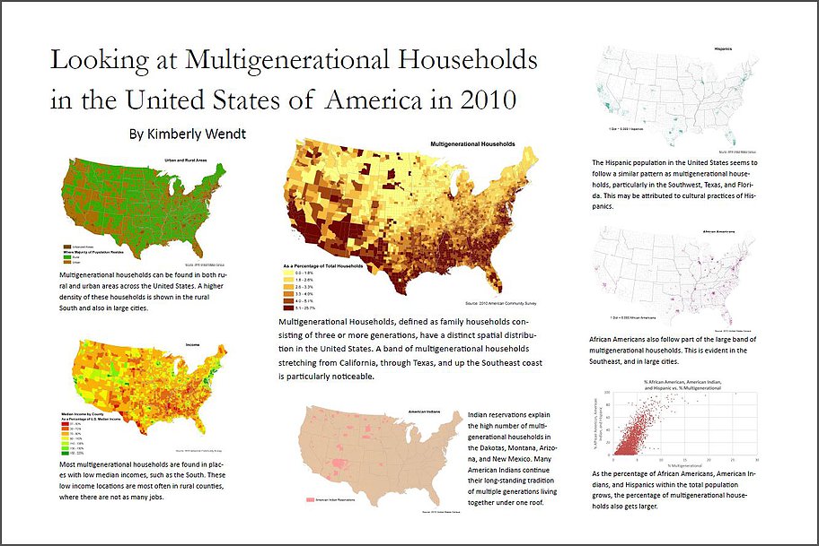
Multigenerational Household Thematic Map-Essay Cartography

Project Description
This is a thematic map-essay that tells a story about multigenerational households in the U.S. The middle map shows the percentage of households that are multigenerational households by county. Each of the other maps and graph shows a different attribute that could be a factor in the number of multigenerational households in a given area. This data was collected from the 2010 U.S. Census and the 2010 American Community Survey. There are examples of choropleth maps, dot density maps, chorochromatic maps, dasymetric maps, and scattergraphs on this poster.
Skills Used
- Thematic Map Design
- Data Gathering
- Table Joins
Back to Projects