Hawaii Tourism Maps Cartography

Project Description
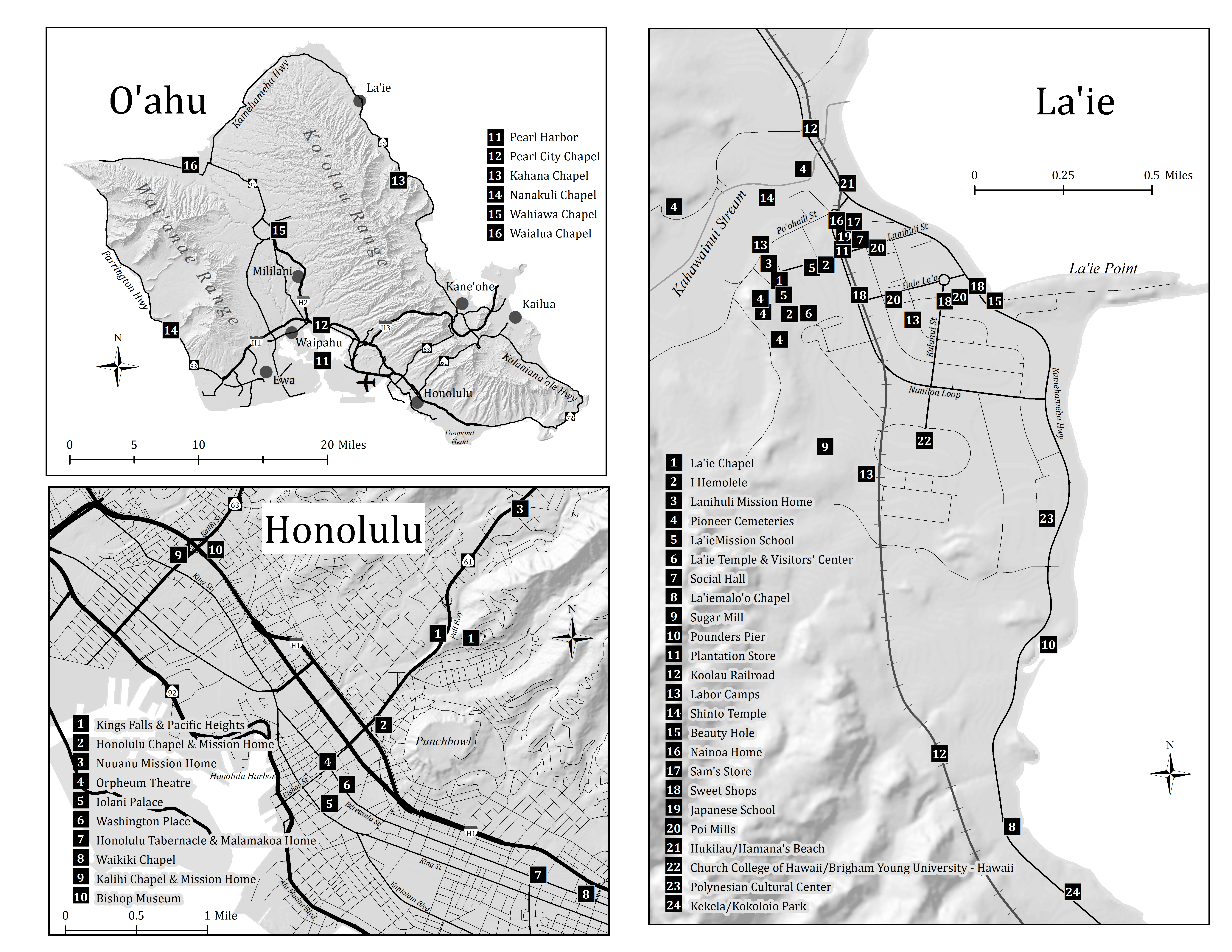
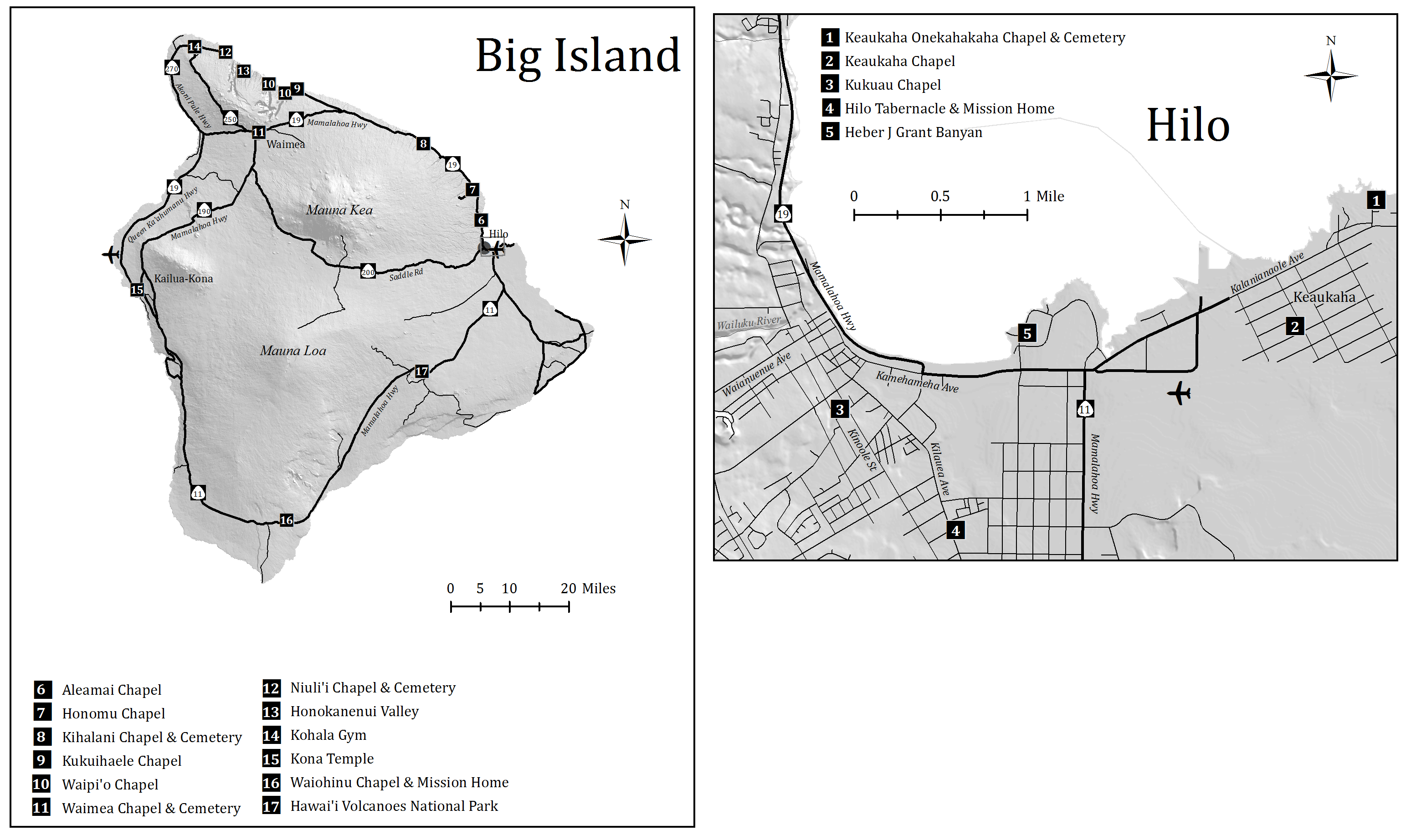
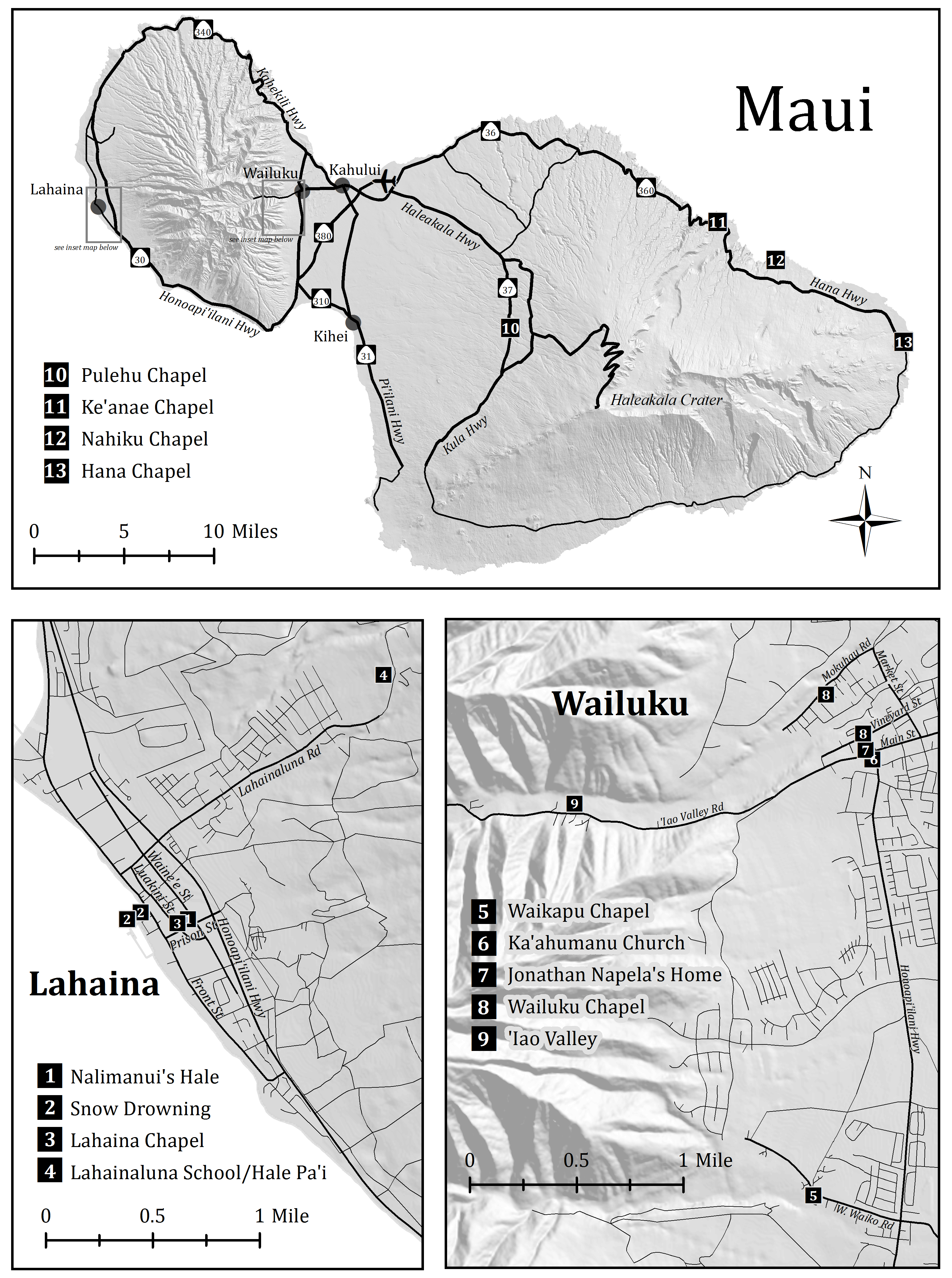
For these maps, our client gave us a list of "Points of Interest" and their relative locations. I found hillshade and road data to use for the maps. I classified the roads to easily see the highways and major roads. I also created symbols for the Hawaiian Highway signs. Airports and other physical land features were also symbolized or labelled. For some of the islands, I made inset maps in order to show all of the "Points of Interest" clearly. I worked closely with another member of our team and our advisor to complete the full set of maps. The maps pictured on this page are the ones I was primarily responsible for.
Skills Used
- Map Design
- Symbology


Back to Projects